Radar of 95L
Over the last few hours, the tracks for 95L has been trending eastward. As of the 2 PM track, the exit point of the disturbance was coastal Glynn County. the estimated time was around 8 PM. The general movement of the storm system is at 5 MPH towards the northeast, but from tracking records, either the storm has stalled or the center keeps jumping around.
Since I can’t trust these tables and track maps, I’ve decided to trust my eyes. Here is a radar image of the area.
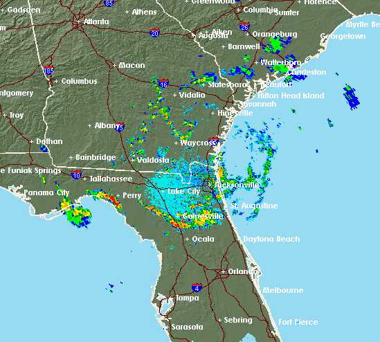
As you can see the center appears to be southeast of Waycross. It might get lost again, or stall out again, but eventually it will reach the Atlantic coast.