Archive for August 3rd, 2015

Radar of 95L

Monday, August 3rd, 2015

Over the last few hours, the tracks for 95L has been trending eastward. As of the 2 PM track, the exit point of the disturbance was coastal Glynn County. the estimated time was around 8 PM. The general movement of the storm system is at 5 MPH towards the northeast, but from tracking records, either the storm has stalled or the center keeps jumping around.

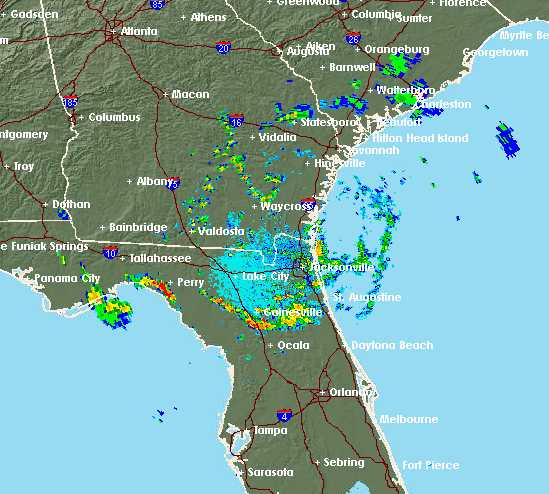
Since I can’t trust these tables and track maps, I’ve decided to trust my eyes. Here is a radar image of the area.

Long range NWS radar, JAX

As you can see the center appears to be southeast of Waycross. It might get lost again, or stall out again, but eventually it will reach the Atlantic coast.
Disturbance 95L

Monday, August 3rd, 2015

The disturbance over Florida has been given a designation of 95L. As of 8 AM, 95L was forecast to travel from the Big Bend area of Florida in a general northeasterly direction until it enters the Atlantic. The computer models are a bit confused about the timing, but not the course. There is good agreement that 95L will pass west and north of Glynn County sometime this afternoon or early evening. The models indicate that 95L has winds of 30 MPH, but I can’t find a central pressure.

As to how much threat it poses … I have no idea. The storm should bring us some rain, but I’d be ready for other threats, such as heavy winds and tornadoes. Our local weather is showing a 40 percent chance of rain this afternoon and evening. It has also been my experience that a feeling of oppressive, still air and high humidity is possible.